Introduction to Using Spatial Data for Global Health
Spatial Health Workshop
Presenter: Carrie Fahey, MPH
Definitions
- Spatial Data
- Data that are referenced to a location.
- The terms geospatial or geographic are commonly used interchangeably with spatial. These specifically refer to a location on the Earth’s surface, while spatial is a more broad term.
- GIS: Geographic Information System
- A system designed to capture, store, manipulate, analyze, manage, and present spatial or geographic data. (Wikipedia)
- Geographic information science (also GIS) is the science underlying geographic concepts, applications, and systems.
- GPS: Global Positioning System
- A satellite-based navigation system used to determine the ground position of an object.
- GPS coordinates are reported as latitude and longitude.
- Geocoding
- The process of converting a postal address into latitude and longitude.
- For example, when you search for an address in Google Maps and it returns a point location.

Spatial Data
Spatial data are multi-dimensional. This makes spatial data somewhat unique, requiring different methods for managing, analyzing, and visualizing data.
Types of spatial data
- Raster: gridded data
- Images (satellite imagery, etc.)
- Vector: collection of points
- Points (health facilities, restaurants, etc.)
- Lines (roads, rivers, etc.)
- Polygons (provinces, districts, etc.)

Note: Raster data are store in image files such as .png, whereas vector data are often stored in shapefiles (.shp).
Where to find spatial data
1. Research studies: Many studies collect spatial data such as postal addresses or GPS coordinates of participant homes or study sites. Ask your advisor to help connect you with a study that has collected spatial data.
2. The Internet! Increasingly, spatial data are publicly available online. Searching with keywords such as “shapefile” or “raster” can help you find readily map-able spatial data.
- Google “Zimbabwe shapefile”
- Google “Zimbabwe raster”
Software for working with spatial data
There are many different software options for working with spatial data. Here are just a few common ones:
Applications to Public Health
- Risk and exposure assessment
- Flood risk
- Drought risk
- Air pollution exposure
- Disease surveillance
- Spatial transmission patterns
- Case clustering
- Health care service planning
- Resource allocation and coordination
- Distance to health facility
- Program monitoring and evaluation
- Spatial distribution of outcomes
- Changes in outcomes over time
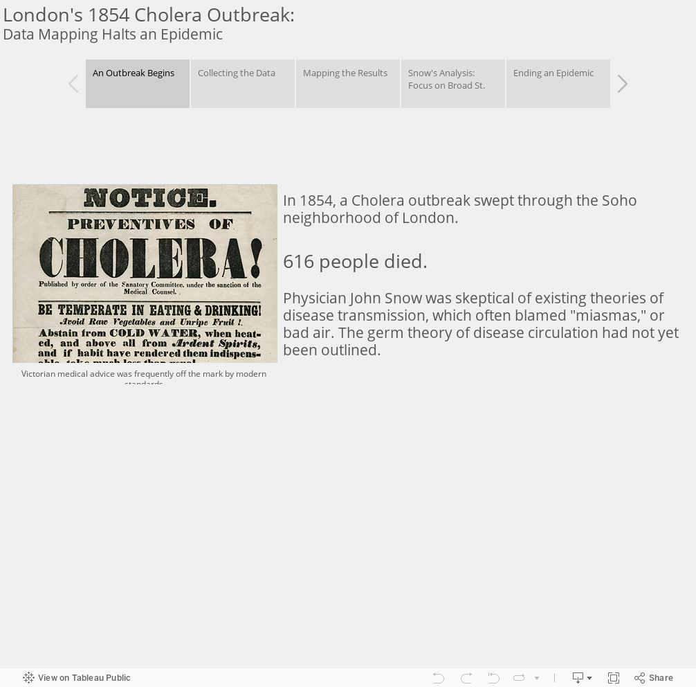
Example 1: John Snow’s Cholera Map (1854)

Image Source. John Snow’s 1854 map of London cholera cases.
Limitations of John Snow’s Map
- Population density not considered.
- Privacy and confidentiality not protected.
Example 2: Geovisualization of Zimbabwe PMTCT Efforts
by Sandra I. McCoy, Carolyn Fahey, Raluca Buzdugan, Angela Mushavi, Agnes Mahomva, Nancy S. Padian and Frances M. Cowan
AIDS (2016)
Background
We assessed Zimbabwe’s progress toward elimination of mother-to-child HIV transmission (MTCT) under Option A.
Methods
We analyzed 2012 and 2014 cross-sectional serosurvey data from mother-infant pairs residing in the same 157 health facility catchment areas randomly sampled from five provinces. Eligible women were at least 16 years and mothers/caregivers of infants born 9-18 months prior. We aggregated individual-level questionnaire and HIV serostatus within catchment areas or district to estimate MTCT and the number of HIV-infected infants; these data were mapped using facility global positioning system coordinates.
Results
- A weighted population of 8800 and 10 404 mother-infant pairs was included from 2012 and 2014, respectively.
- In 2014, MTCT among HIV-exposed infants was 6.7% (95% confidence interval: 5.2, 8.6), not significantly different from 2012 (8.8%, 95% confidence interval: 6.9, 11.1, P=0.13).
- From 2012 to 2014, self-reported antiretroviral therapy or prophylaxis among HIV-infected women increased from 59 to 65% (P<0.05), as did self-reported infant antiretroviral prophylaxis (63 vs. 67%, P=0.08).
- In 2014, 65 (41%), 55 (35%), and 37 (24%) catchment areas had the same, lower, and higher MTCT rate as in 2012, respectively.
- MTCT in 2014 varied by catchment areas (median=0%, mean=4.9%, interquartile range=0-10%) as did the estimated number of HIV-infected infants (median=0, mean=1.1, interquartile range=0-1.0).
- Also in 2014, 106 (68%) catchment areas had MTCT=0%.
- Geovisualization revealed clustering of catchment areas where both MTCT and the estimated number of HIV-infected infants were relatively high.
Maps

Estimated number of HIV-infected infants and MTCT rate in 156 selected health facility catchment areas in five provinces in Zimbabwe, 2012 and 2014. Data from pregnant women and their infants were linked to health facility catchment area; their inclusion in a particular area does not necessarily imply that the mother-infant pair received care at that facility, or received care at all.

Estimated number of HIV-infected infants and MTCT rate in 156 selected health facility catchment areas in five provinces in Zimbabwe, 2014. High priority catchment areas (as determined with our algorithm) are labeled with a star. Maternal ART/antiretroviral coverage in the background.

Estimated number of HIV-infected infants and MTCT rate in 156 selected health facility catchment areas in five provinces in Zimbabwe, 2014. High priority catchment areas (as determined with our algorithm) are labeled with a star. HIV prevalence in the background.
Conclusion
Although MTCT is declining in Zimbabwe, geospatial analysis indicates facility-level variability. Catchment areas with high MTCT rates and a high burden of HIV-infected infants should be the highest priority for service intensification.
Example 3: Spatial Analysis of HIV in East Zimbabwe
by Robin Schaefer, Simon Gregson, Albert Takaruza, Rebecca Rhead, Tidings Masoka, Nadine Schur, Sarah-Jane Anderson and Constance Nyamukapa
JIAS (2017)
Introduction
Focusing resources for HIV control on geographic areas of greatest need in countries with generalized epidemics has been recommended to increase cost-effectiveness. However, socioeconomic inequalities between areas of high and low prevalence could raise equity concerns and have been largely overlooked. We describe spatial patterns in HIV prevalence in east Zimbabwe and test for inequalities in accessibility and uptake of HIV services prior to the introduction of spatially-targeted programmes.
Methods
8092 participants in an open-cohort study were geo-located to 110 locations. HIV prevalence and HIV testing and counselling (HTC) uptake were mapped with ordinary kriging. Clusters of high or low HIV prevalence were detected with Kulldorff statistics, and the socioeconomic characteristics and sexual risk behaviours of their populations, and levels of local HIV service availability (measured in travel distance) and uptake were compared. Kulldorff statistics were also determined for HTC, antiretroviral therapy (ART), and voluntary medical male circumcision (VMMC) uptake.
Results
- One large and one small high HIV prevalence cluster (relative risk [RR] = 1.78, 95% confidence interval [CI] = 1.53- 2.07; RR = 2.50, 95% CI = 2.08-3.01) and one low-prevalence cluster (RR = 0.70, 95% CI = 0.60-0.82) were detected. The larger high-prevalence cluster was urban with a wealthier population and more high-risk sexual behaviour than outside the cluster.
- Despite better access to HIV services, there was lower HTC uptake in the high-prevalence cluster (odds ratio [OR] of HTC in past three years: OR = 0.80, 95% CI = 0.66-0.97). The low-prevalence cluster was predominantly rural with a poorer population and longer travel distances to HIV services; however, uptake of HIV services was not reduced.
Maps

Figure 1. Study districts in Manicaland, Zimbabwe, and study area. (a) Zimbabwe with the three study districts in Manicaland (1: Makoni; 2: Nyanga; 3: Mutasa). (b) The study area (grey) for the interpolation mapping was restricted to the dissolved area of 12.5 km radius circles around each study location (black dots) within the study districts to create a continuous mapping surface. (c) The study area for the interpolation mapping with study locations, larger settlements, the provincial capital (Mutare) and roads indicated.

Figure 2. HIV prevalence in the study area. Interpolation of age-standardized HIV prevalence for both sexes combined. Clusters of HIV prevalence are indicated.

Figure 3. HTC and VMMC uptake in the study area in relation to health service availability. Spatial patterns of uptake of age-standardized HTC uptake (shadings on the map) and locations of VMMC uptake clusters (in the south and east) are shown in relation to the availability of health services (any type of health facility and hospitals) and the locations of the high HIV prevalence clusters (red circles around Nyazura and Nyanga) and the low HIV prevalence cluster (blue circle in the western central area) in the study area, Manicaland, Zimbabwe.
Conclusions
High-prevalence clusters can be identified to which HIV control resources could be targeted. To date, poorer access to HIV services in the poorer low-prevalence areas has not resulted in lower service uptake, whilst there is significantly lower uptake of HTC in the high-prevalence cluster where health service access is better. Given the high levels of risky sexual behaviour and lower uptake of HTC services, targeting high-prevalence clusters may be cost-effective in this setting. If spatial targeting is introduced, inequalities in HIV service uptake may be avoided through mobile service provision for lower prevalence areas.